
Last modified: 2007-03-31 by ivan sache
Keywords: pavillon d'arrondissement | registration flag | french colonies |
Links: FOTW homepage |
search |
disclaimer and copyright |
write us |
mirrors
See also:
French merchant ships had to hoist at foremast a specific flag indicating in which arrondissement they were registered. The French coasts were divided in five metropolitan maritime arrondissements, each of them being divided in two sectors, and in
two colonial sectors.
The arrondissement flags were established by Royal Regulation of 3 December 1817, signed by Louis XVIII. They were confirmed in the 1852 Imperial Regulations on naval flags signed by Napoléon III and by Decree on 20 March 1868. These flags are still shown in Grand Larousse Illustré du XXe siècle (1928). They were probably abolished in 1929.
Annuaire de la Marine de Commerce (Merchant Navy Yearbook), 1868, gives the Decree of 20 March 1868:
Police de navigation.Tous les navires sont portés sur le matricule tenu dans les quartiers maritimes.
Le pavillon français est porté à la poupe et à défaut de mât de pavillon à la corne d'artimon.
Un pavillon spécial, conforme au modèle annexé au règlement du 3 décembre 1817 est affecté à chacun des arrondissements maritimes. Le pavillon est porté en tête du grand mât.
Les armateurs des navires sont tenus de faire connaître au bureau de l'inscription maritime les marques de reconnaissance dont ils veulent faire usage, et ils ne peuvent les employer qu'après en avoir fait la déclaration, qui est enregistrée et mentionnée sur le rôle d'équipage du navire. La marque de reconnaissance est hissée en tête du mât de misaine.(Règlement 3 déc. 1817 - Décret 20 mars 1868).
Unofficial translation:
Navigation police.All ships shall be registered on the roll hold in the maritime quartiers.
The French ensign shall be hoisted on stern and, if there is no flag mast, on the mizzen horn.
A specific flag, true to the model shown in the Appendix to the 3 December 1817 Regulation, shall be assigned to each maritime arrondissement. This flag shall be hoisted on top of the mainmast.
The shipowners must announce to the office of the Register of Sailors the house flags they want to use. They may use them only after their notification, which shall be registered and mentioned on the ship muster roll. The house flag shall be hoisted on top of the foremast.(Regulation from 3 December 1817 - Decree from 20 March 1868).
There are today only three maritime regions (régions maritimes), with the military ports Cherbourg, Brest and Toulon as their respective préfecture maritime.
The civil divisions of the French coasts are the quartiers maritimes. Each
quartier is named after a port and has a two-letter code that must be
painted on the hull of the ship, as follows:
| AC Arcachon | FC Fécamp | PV Port-Vendres |
| AD Audierne | FF Fort-de-France (Martinique) | PY Papeete (French Polynesia) |
| AJ Ajaccio | GV Le Guilvinec | RO Rouen |
| AY Auray | LH Le Havre | RU Reunion |
| BA Bayonne | LO Lorient | SB Saint-Brieuc |
| BI Bastia | LR La Rochelle | SM Saint-Malo |
| BL Boulogne-sur-Mer | LS Les Sables-d'Olonne | SN Saint-Nazaire |
| BR Brest | MA Marseilles | SP Saint-Pierre-et-Miquelon |
| BX Bordeaux | MN Marennes-Oléron | ST Sète |
| CC Concarneau | MT Martigues | TL Toulon |
| CH Cherbourg | MX Morlaix | VA Vannes |
| CM Camaret | NA Nantes | YE Yeu |
| CN Caen | NC Nouméa (Nouvelle-Calédonie) | |
| CY Cayenne (French Guiana) | NI Nice | |
| DP Dieppe | NO Noirmoutier | |
| DK Dunkirk | PL Paimpol | |
| DZ Douarnenez | PP Pointe-à-Pitre (Guadeloupe) |
Ivan Sache & Dominique Cureau, 27 January 2007
Each arrondissement was divided into two sectors, which had flags with the same colours but arranged differently.
Pierre Charrié (Drapeaux et étendards du XIXe siècle
[chr92]) shows a black-and-white facsimile of the plate
entitled Pavillons d'Arrondissements des Côtes de France
(Arrondissement Flags of the Coasts of France), from Album des pavillons,
guidons et flammes de toutes les puissances maritimes (Album of
ensigns, pennants and wimpels of all maritime powers) by Legras
(1858) [leg58]. Charrié also gives
a written description of the flags, with a few mistakes listed below.
Commander Jean-Paul Redon provides additional information and
sketches of these flags in Franciae Vexilla
[frv] #7/53 (November 1997). Redon's source is not mentioned; the flags, however, are shown in the aforementioned Grand Larousse Illustré du XXe siècle, which gives the following definition for the flags:
Pavillon indiquant à quelle zone militaire appartient telle partie des côtes de France, that is "Flag showing to which military zone belongs a given
part of the French coasts."
Ivan Sache, 12 March 2005
![[Dunkirk sector]](../images/f/fr~a-c1.gif)
![[Honfleur sector]](../images/f/fr~a-c2.gif)
Flags of the arrondissement of Cherbourg - Images by Ivan Sache, 11 July 2000
Left, sector from Dunkirk to Honfleur, included
Right, sector from Honfleur to Granville, excluded
The flag of the Dunkirk-Honfleur sector is swallow-tailed, horizontally divided blue-white-blue-white. Redon writes "From the Belgian border" instead of the original "From Dunkirk" (Belgium did not exist as an independent state before 1830).
The flag of the Honfleur-Granville sector is triangular, vertically divided blue-white-blue.
Blue and white are the traditional colours of Dunkirk and Granville.
Charrié erroneously writes "green" instead of "blue" for the two flags.
Ivan Sache, 12 March 2005
![[Granville sector]](../images/f/fr~a-b1.gif)
![[Morlaix sector]](../images/f/fr~a-b2.gif)
Flags of the arrondissement of Brest - Images by Ivan Sache, 11 July 2000
Left, sector from Granville to Morlaix, excluded
Right, sector from Morlaix to Quimper, excluded
The flag of the Granville-Morlaix sector is swallow-tailed, vertically divided blue-yellow-blue-yellow.
The flag of the Morlaix-Quimper sector is triangular, vertically divided blue-yellow.
Ivan Sache, 12 March 2005
![[Quimper sector]](../images/f/fr~a-l1.gif)
![[Lorient sector]](../images/f/fr~a-l2.gif)
Flags of the arrondissement of Lorient - Images by Ivan Sache, 11 July 2000
Left, sector from Quimper to Lorient, included
Right, sector from Lorient to the left (south) bank of river Loire, included
The flag of the Quimper-Lorient sector is swallow-tailed, horizontally divided blue-red-blue.
The flag of the Lorient-Loire sector is triangular, horizontally divided blue-red.
Ivan Sache, 12 March 2005
![[Loire sector]](../images/f/fr~a-r1.gif)
![[Royan sector]](../images/f/fr~a-r2.gif)
Flags of the arrondissement of Rochefort - Images by Ivan Sache, 11 July 2000
Left, sector from the left (south) bank of river Loire to Royan, included
Right, sector from Royan to the Spanish border
The flag of the Loire-Royan sector is swallow-tailed, horizontally divided green-white-green.
The flag of the Royan-Spain sector is green with two white triangles placed vertically along the hoist.
Charrié erroneously writes "blue" instead of "green" for the two flags.
Ivan Sache, 12 March 2005
![[Marseilles sector]](../images/f/fr~a-t1.gif)
![[Toulon sector]](../images/f/fr~a-t2.gif)
Flags of the arrondissement of Toulon - Images by Ivan Sache, 11 July 2000
Left, sector from the Spanish border to Marseilles, included
Right, sector from Marseilles to the Piedmontese / Italian border
The flag of the Spain-Marseilles sector is swallow-tailed, horizontally divided white-red-white-red.
The flag of the Marseilles-Piedmont / Italy sector is red with two white triangles placed vertically along the hoist.
Redon writes "from Marseilles to the Italian border"
instead of the orginal "from Marseilles to the Piedmontese border" (Italy did not exist before 1861).
Ivan Sache, 12 March 2005
![[Western colonies]](../images/f/fr~a-wc.gif)
![[Eastern colonies]](../images/f/fr~a-ec.gif)
![[Eastern colonies]](../images/f/fr~a-e1.gif)
Flags of the colonies - Images by Ivan Sache, 27 January 2007
Top, Western colonies
Bottom, Eastern and African colonies; left, as shown in most sources, right, as shown in a single source
For the purpose of ship registration, the French colonies were divided into two parts:
- the flag of the Western colonies is quartered blue-yellow.
Redon writes Ponant instead of "Western colonies". Ponant (from popular Latin sol ponens ,"setting sun"), is a mostly forgotten word for West, as opposed to Levant, "rising sun", for East; however Brest is still called port
militaire du Ponant because in the past there was the flotte
du Ponant, the Atlantic fleet, as opposed to the flotte du
Levant, the Mediterranean fleet; Levantin is still used to
design peoples from Eastern Mediterranean countries. The Echelles
du Levant were the trading posts established by Christian nations
from the XVIth century in the Eastern Mediterranean Moslim states.
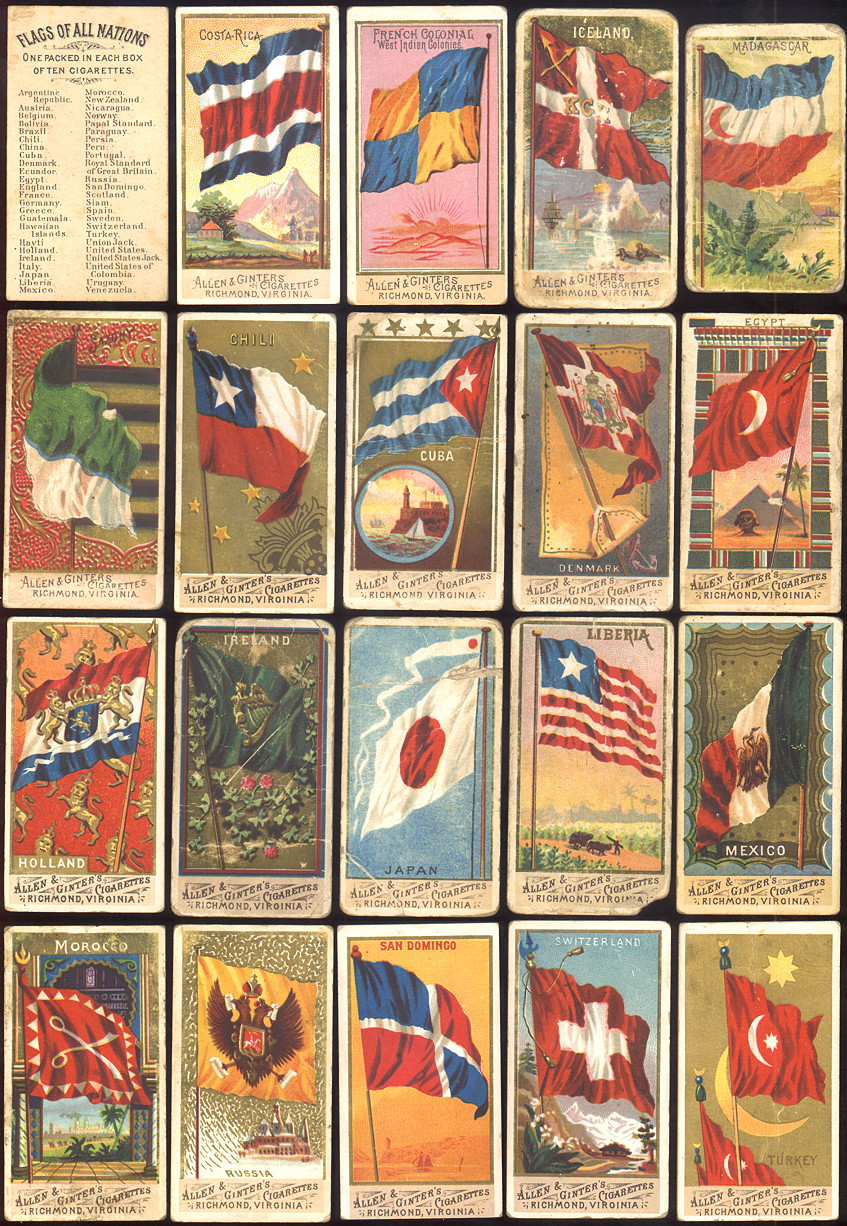
The Norie & Hobbs's flag chart (1848) [noh48] shows this flag for "French Colonies, Western", whereas Bromme's Flaggen und Atlas (1862) [bmm62] shows it for Frankreich Westind. Kolonien (French West Indies Colonies). The flag is also shown on a cigarette card from the Allen & Ginter's Cigarette Cards album "N9 Flags of all Nations" [u9s8Xa].
- the flag of the Eastern and African colonies is vertically divided yellow-red. Redon writes Orient instead of "Eastern colonies and Africa coast". Orient [East] is the origin of the name of Lorient, formerly L'Orient.
The Norie & Hobbs's flag chart (1848) [noh48] shows this flag for shows this flag for "French Colonies, African & Eastern", whereas Bromme's Flaggen und Atlas (1862) shows it for
Frankreich Ostind Kolonien (French East Indies Colonies).
A colour plate with the arrondissement flags shows the flag of the Eastern colonies as vertically divided red-yellow. The plate is undated but shows the Imperial flag and mentions the Piedmontese border, and must therefore have been published not later than the end of the XIXth century. Since it is the only source to show a yellow-red flag, we can assume that it is erroneous.
Ivan Sache, Nozomi Kariyasu, Tomislav Šipek & Dominique Cureau, 27 January 2007